Quick Menu
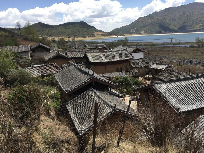
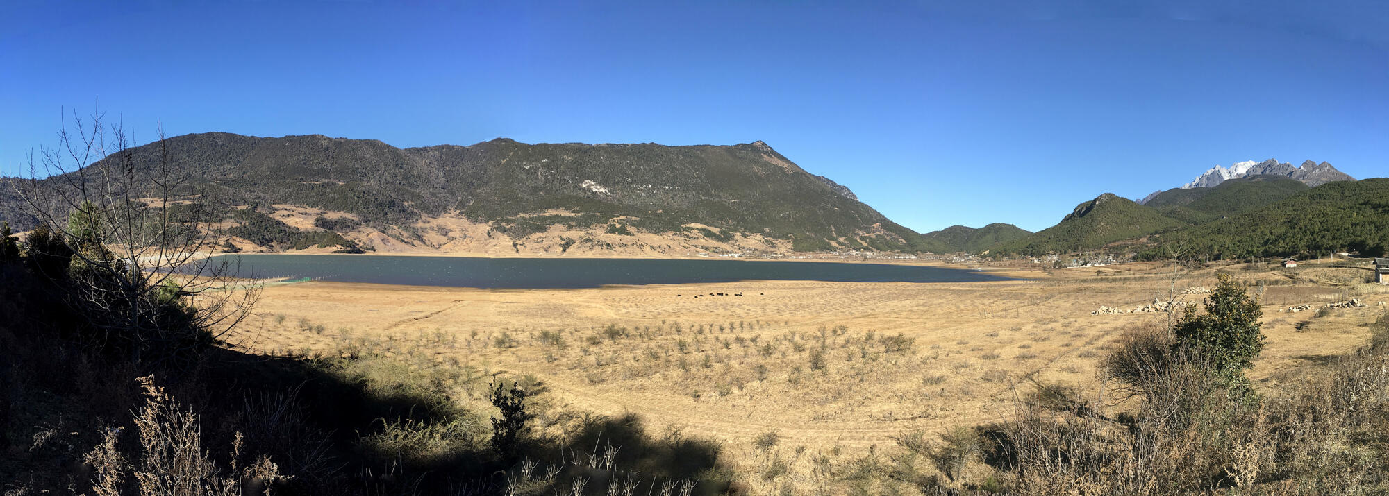
Wenhai Mountain (文海山) rises above a lake of the same name, a sub-alpine body of water nestled among the foothills of Lijiang's Jade Dragon Snow Mountain. On the shore sits Wenhai Village, elevation 3,100 meters, inhabited by members of the Naxi ethnic minority. They have lived here for 300 years, making a living from agricultural and livestock.
Decidedly remote and isolated until recently, Wenhai Village received electricity in 1997. In 2003, the track from the valley was paved, allowing the first access by privately owned cars and trucks. Until then, any materials brought to the village had to ride up on the backs of humans or mules.
According to the website Yulong, local residents say, "the old name of the village, Gan Haizi (Dry Sea), was changed to Wen Hai (Culture Sea) shortly after the Communist Revolution, in order to inspire the universally illiterate villagers to transform their village into a reservoir of culture." Since then, with improved access to education and an increase in standards of living, the village has indeed taken many positive steps forward.
About the Wenhai area
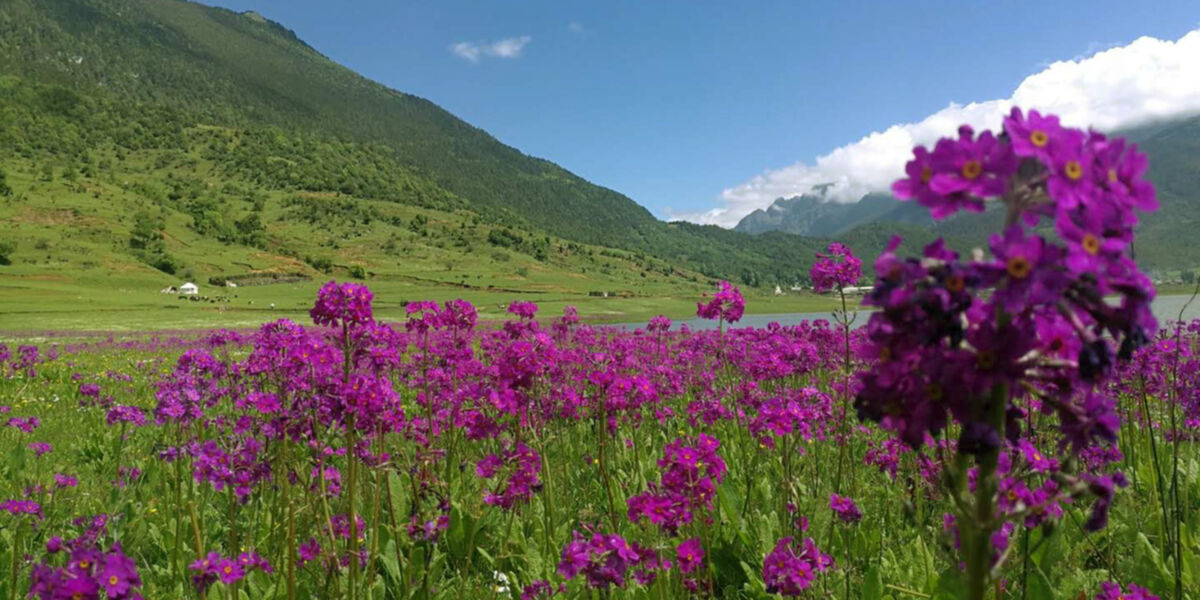
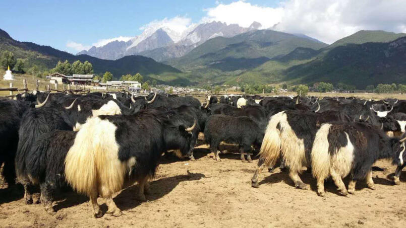
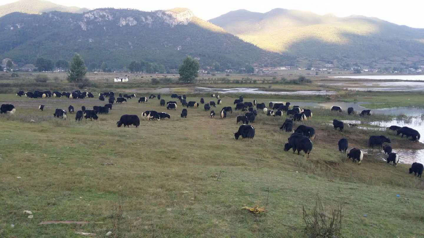
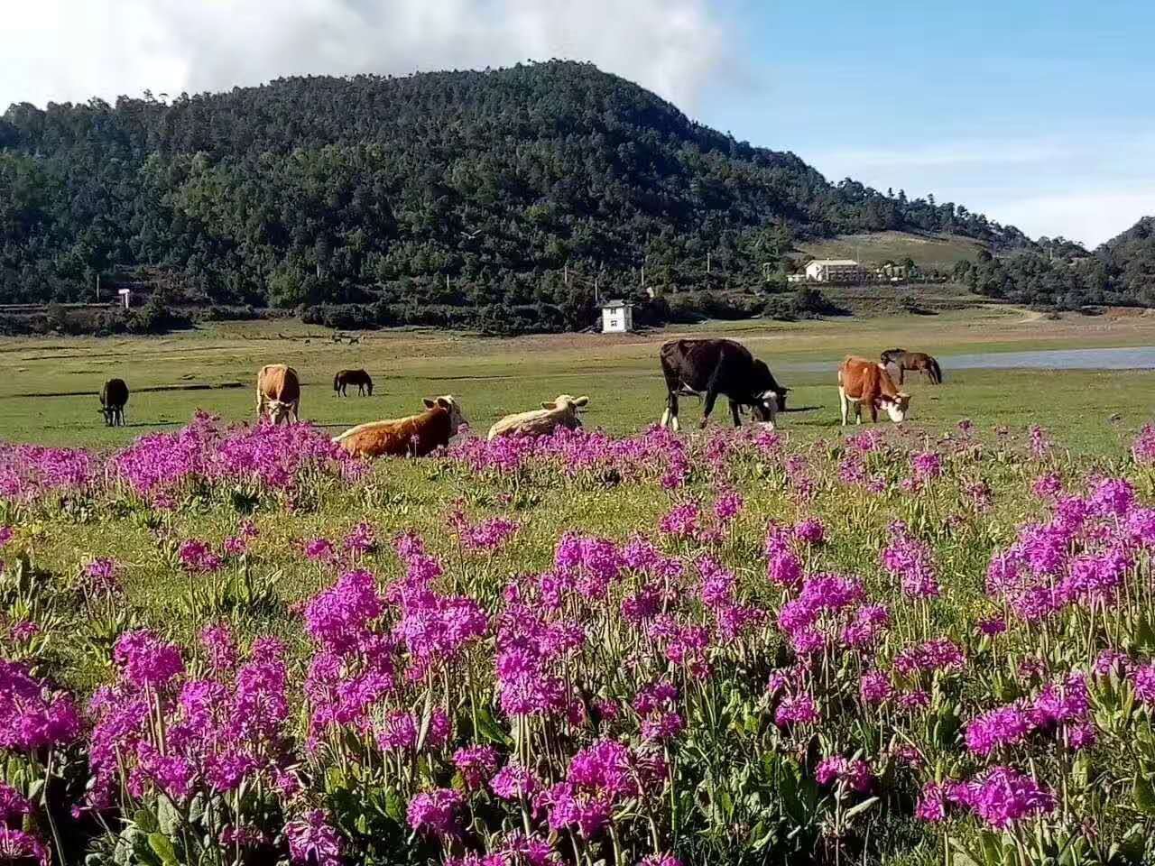
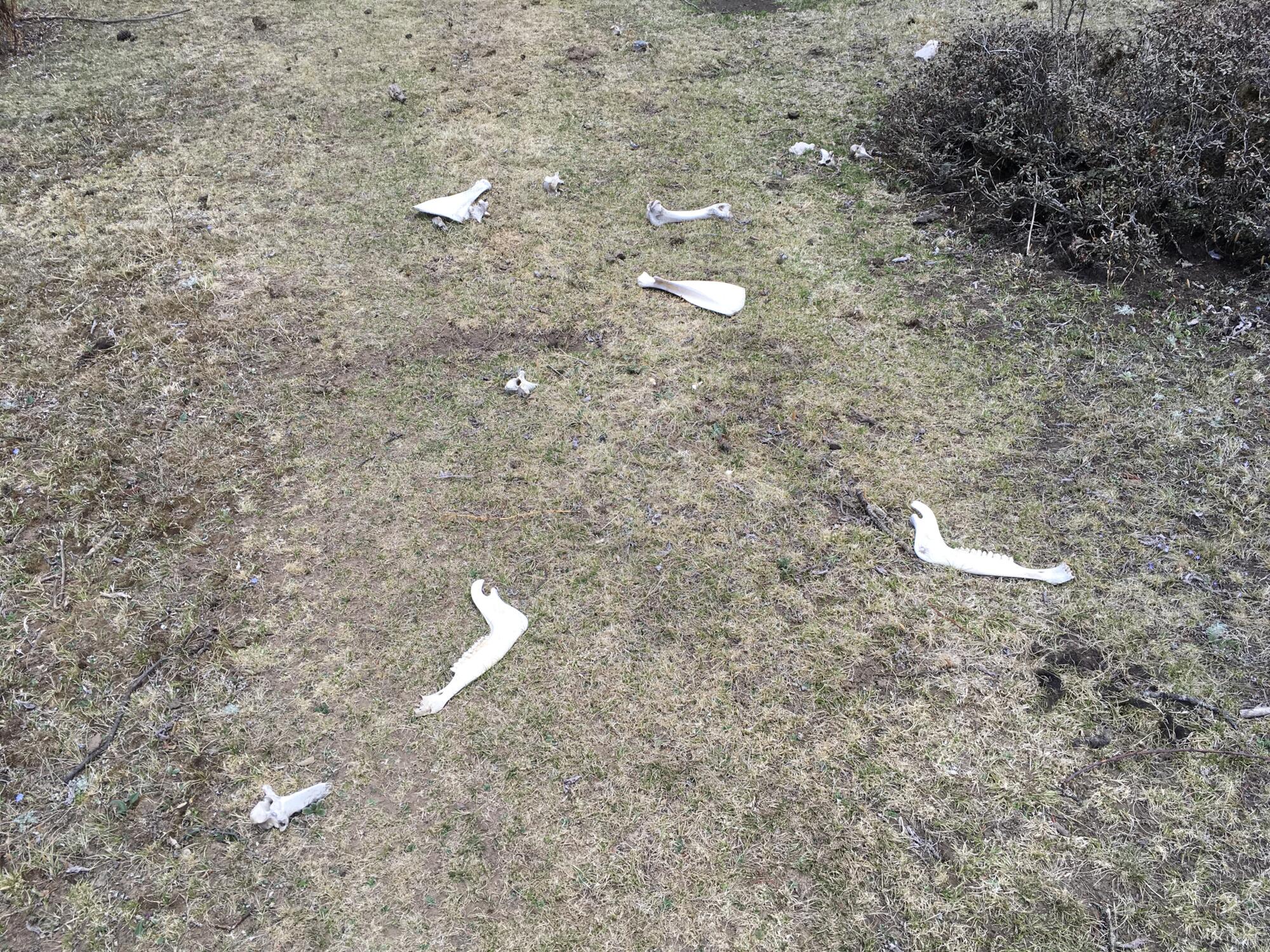
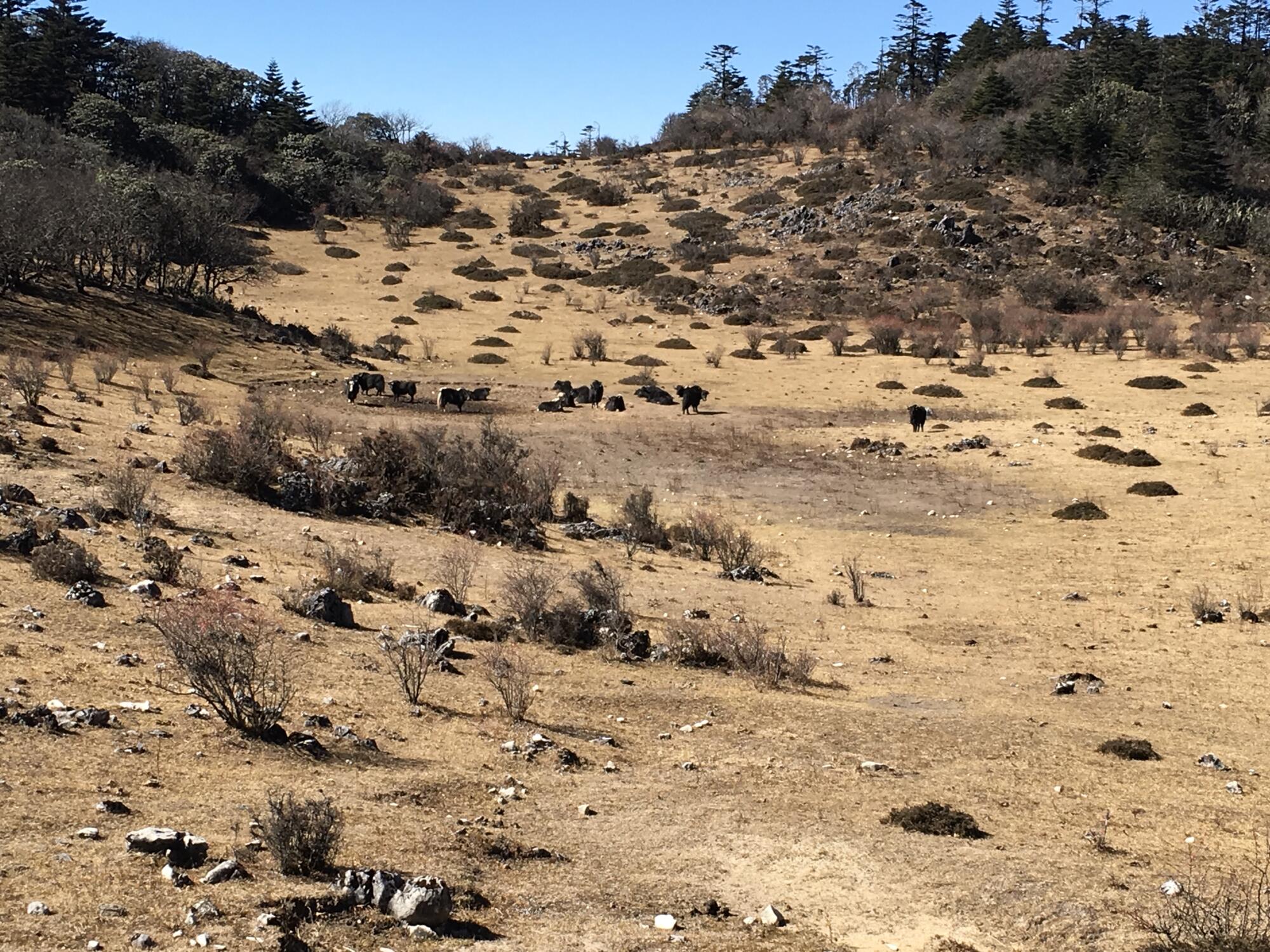
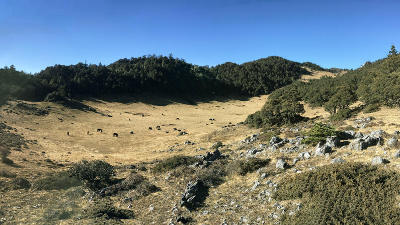
Historically, Wenhai Lake filled seasonally, reaching full capacity during the summer rains, then draining naturally over the course of the dry season. In winter, migrating birds arrive from other parts of China and as far away as Siberia. Summertime offers an idyllic scene — grazing herds of yak amidst plush green meadows and purple fields of primrose.
In 2016, the government completed a dam across the lake's southern shore. Some may sorrow over this alteration of the valley's natural aesthetics. Local residents, however, tend to support the benefits of modern progress provided by the government. One local explained to me the reason for the dam was to provide a supplementary water supply to the city of Lijiang. A large pipe brings water down to town when needed now.
According to my sources, the dam changed the natural water cycle of the valley. The lake never dries out seasonally as it used to — some water remains year-round. So is it a lake? A reservoir? With construction of the dam, another name change may be in order.
Since the turn of the twenty-first century, foreign and Chinese trekkers have come to frequent Wenhai valley. They come to enjoy the spectacular natural environment, where indigenous people continue traditional rural lifestyles, far removed from the crowds and hustle of city life. Native languages are spoken and many women still wear ethnic clothing.
One popular two-day trek starts at Shuhe Village (束河村), just north of Lijiang, and ascends to Wenhai. The second day continues on to the next valley north, home to Snowflake Village (雪花村), inhabited by the Yi ethnic minority. Some hikers go beyond the village all the way down to the Jinsha River (金沙江), the headwaters of the Yangtze. From there, a short drive leads to Qiaotou (桥头) and the fabled depths of Tiger Leaping Gorge (虎跳峡).


Other treks remain popular. For example, from Wenhai down to Lashi Lake (拉市海). Yet another climbs up to the valley from Yuhu Village (玉湖村), situated on the broad plain north of Lijiang. For many years, Yuhu was home base of the famous explorer-botanist Joseph F Rock. I'll write about these treks in later articles.
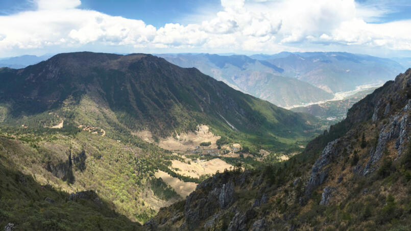
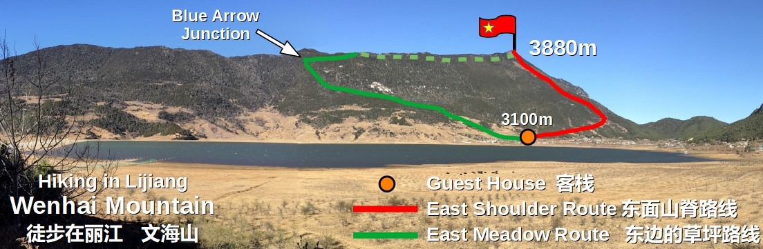
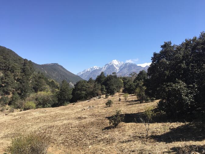
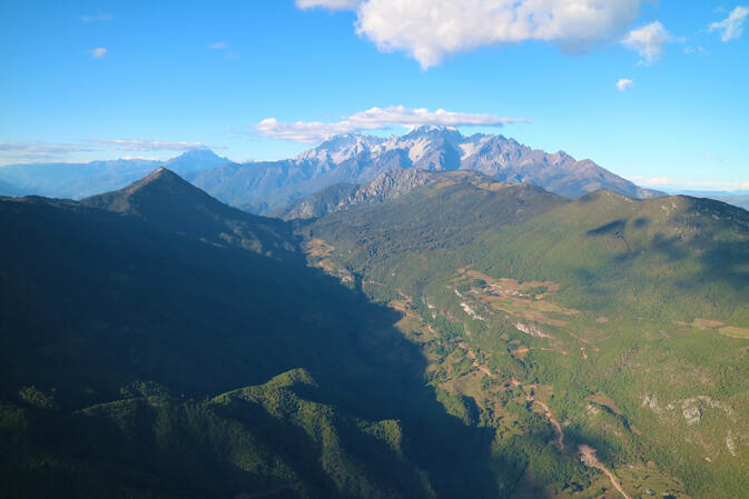
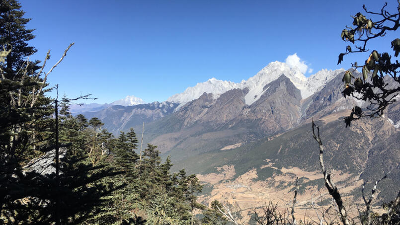
Mountainous ridges ring the Wenhai Valley. Fourteen kilometers to the north, Jade Dragon Snow Mountain soars to an elevation of 5,596 meters. The highest peak immediately adjacent to the lake rises to the northwest, reaching 3,880 meters. This is Wenhai Mountain.
I asked local residents for the name of the mountain, but they disagreed among themselves, perhaps due to language differences among Han, Naxi and Yi. Some even told me it has no name. Viewed from Lashi Lake, the mountain's southern aspect includes bright bands of cliffs, leading the locals there to call it Baitoushan (白头山), or "White Top Mountain". Since there is no consensus, I shall call it Wenhai Mountain for convenience. Just know that nobody in the area will recognize it by that name.
You may choose from two routes, the East Shoulder Route or the preferred Meadow Route, which offers both east and west variations. The latter is named for an extensive meadow halfway up which extends nearly to the top. From the meadow, good views extend in all directions except to the north.
Jade Dragon and Haba Snow Mountain lie to the north, but with effort, one can find openings on the wooded summit ridge affording good views. On clear days, you can just make out several other snow-covered mountains far to the west. They rise above the Nujiang and Lancang Rivers near the border with Myanmar. By the way, searching for the highest point, wherever it may be found along that long and forested summit ridge, provides an exercise in frustration that many may choose to forego.
The ascent of Wenhai Mountain lasts longer, climbs higher, and presents a more serious undertaking than peaks described previously in this series. Depending upon current conditions, route-finding and bushwhacking skills may prove essential for a successful outing. Before the hike, you would be wise to spend several days acclimatizing to altitude in Lijiang or Wenhai, as the summit approaches 4,000 meters in elevation.

East Shoulder Route
From the guesthouse — discussed below — in Wenhai Village, the east shoulder of Wenhai Mountain appears against the skyline. Near the bottom of the shoulder sits a prominent step with a meadow right below it. The direct and very steep ascent from this step may prove uncomfortably steep for many folks.
This route offers two advantages. First, it provides many views of Jade Dragon Snow Mountain, and second, it allows for a loop hike, returning to the valley by the aforementioned Meadow Route in either its east or west variations. Please note, this route requires route-finding and bushwhacking skills as well as use of hands while scrambling on steep terrain. Descent of the route is not recommended due to the vertical grade and loose rocks.
From the guesthouse, walk to the meadow which surrounds the village on the west. Walk north on a gradually ascending route through meadows and forest to the East Shoulder step, sometimes following severely rutted paths.
At the step, turn left on a well-beaten track that heads up the mountain. The path straight ahead leads to the next valley north, where there are several Yi villages, while a middle path traverses the side of the mountain. Ascending by switchbacks or heading straight up the fall line, the track may peter out here and there, requiring bushwhacking through open forest.
After reaching a meadow on the upper part of the route, the slope steepens significantly and requires several exposed scrambling moves before reaching the summit meadow. Ascend easily a short distance to the top. From the guesthouse to the top takes three hours, with an elevation gain of 800 meters.
East Meadow Route
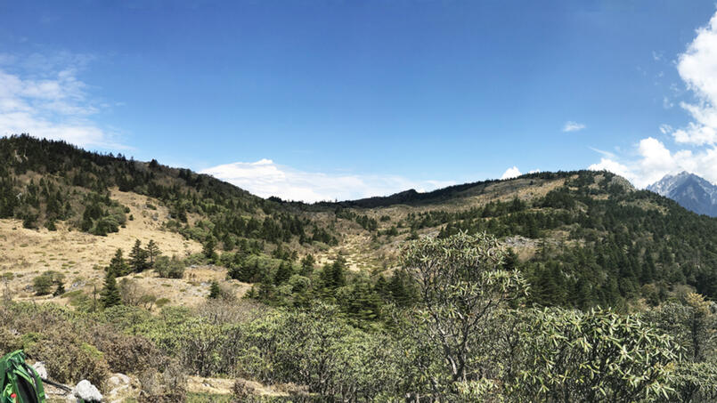
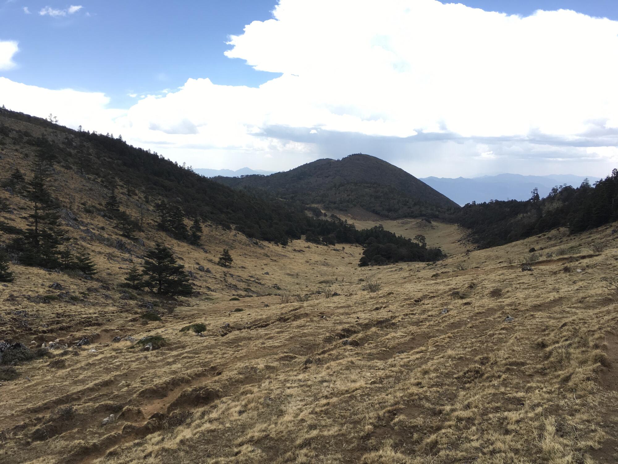
This is the recommended route up Wenhai Mountain. Be aware that depending on the path chosen, the ascent requires common sense route-finding and may involve bushwhacking. The upper part of the route consists of an extensive meadow system providing wide-ranging views pretty much all the way to the top.
Actually, there are two separate and parallel meadows, both oriented in a north-south direction. Due to a forested ridge in between, visibility between the two is limited. I refer to them as the West Meadow and East Meadow, and they are each from one to two kilometers long. The West is the longer of the two. The route I describe here ascends the East Meadow.
From the guest house in Wenhai Village, walk to the meadow which surrounds the village on the west. Above you will see a ridge covered by trees. Head straight up to this ridge, gaining perhaps fifty meters in elevation. A small pond or watering hole — dry for part of the year — sits atop the ridge. Walk to the left of the pond and continue ascending. Shortly a second small pond, which also may be dry, appears and is surrounded by meadow. Pass around the pond, ascend to the upper part of the meadow and find a well-beaten track. Be sure to walk to the highest part of the meadow west of the pond before looking for the track.
Note the band of ledges and cliffs girdling the mountain above. From here, the track heads in a generally southwest direction, staying below the cliffs, until it can pass them on the left. Upon reaching another meadow with views of Wenhai Village, the crags appear prominently above and straight ahead. The path zig-zags occasionally as it continues in a southwest direction, then heads in a westerly direction for a spell.
Eventually you will arrive at the intersection called Blue Arrow Junction, an incline of sand and dirt. Here, paths diverge left, straight ahead, and to the right. To continue on the East Meadow Route, you should take the right turn. Near the junction sits an obscure rock with a faded blue arrow pointing downhill. This was for the benefit of hikers on the descent.
After turning right at Blue Arrow Junction, the trail heads north, levels off and makes a slight descent to the East Meadow. If you plan to descend this route, take careful note of where the trail enters the meadow. From here on upward you'll walk through the open meadow. To reach the top, perched 800 meters higher than the guest house, takes three hours from start to finish.


Notes for descending East Meadow Route
From the summit ridge of Wenhai Mountain, take a moment to locate the watering hole situated in the summit meadow (see map). The hole is dry part of the year. On the descent, stay well to the left of this landmark to ensure that you enter the East Meadow. If you stray to the right of it, you will end up in the West Meadow.
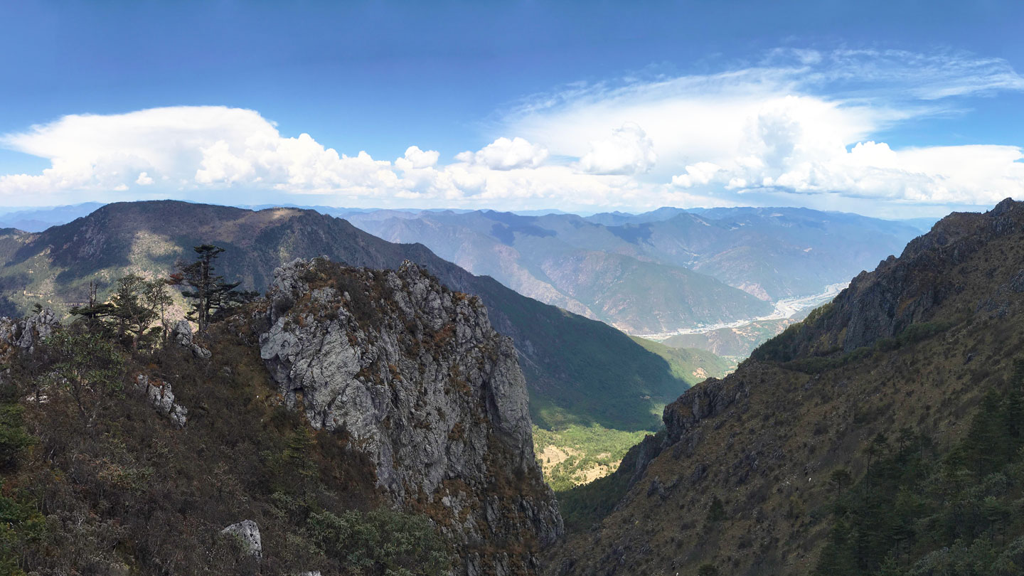
I recommend a side trip to the watering hole, if you have time. So long as water remains, yaks and horses graze the area. Just west of the hole, ascend a few meters to the canyon rim for an impressive view of the Jinsha River, two-thousand vertical meters below. I don't know for sure — there were clouds the day I hiked — but I suspect the view northwest from here includes the snowy massif of Kawagarbo, also known as Meili Xueshan (梅里雪山), at 6,740 meters, the highest peak in Yunnan Province.
Going down the length of the East Meadow, various paths head off east toward Wenhai Lake. Some of them peter out in steep and dangerous terrain. Remember those cliffs I mentioned earlier? If you ascended the East Meadow Route, then you should already know how to retrace your steps safely.

However, if, after leaving the meadow and descending through forest, you find yourself with no trail on steep terrain, I strongly recommend going back uphill until you find the actual path and continue down from there. There is an alternative approach to descending the East Meadow. This may be especially useful to those who climbed the peak by a different route.
The key here is to descend all the way down to the lowest part of the East Meadow, then continue along the Inter-Meadow Link until it reaches the West Meadow. At this point, the trail crosses over a low ridge with rocky outcrops and exits the forest. Now, turn around and retrace your steps back along the trail and into the forest for perhaps 40 meters. Then turn off the trail, bushwhacking downhill through open forest and passing through an area of woodcutting. After 200 meters, you will pick up the trail at Blue Arrow Junction, the intersection mentioned above on the ascent. Continue down the route to the guest house.
West Meadow Route
If you wish to ascend the West Meadow rather than the East, simply continue straight ahead at Blue Arrow Junction, the intersection described above under the East Meadow Route section. After a short uphill hike and bushwhack — around 200 meters in all — you will arrive at the well-beaten track of the Inter-Meadow Link.
Turn left for the West Meadow. As you follow the meadow higher, the route traverses a couple of surprisingly flat sections. Above the meadow, climb over a forested pass, then make a slight descent to the summit meadow where, shortly above, lies a watering hole.

Notes for descending West Meadow Route
At the top of the mountain, if you wish to descend the West Meadow, take a moment to locate the (possibly dry) watering hole in the summit meadow. Descend to the right of the watering hole to ensure you end up in the West Meadow. Beyond the hole you will cross over a forested pass, then traverse long stretches of downhill and level ground through the meadow.
Near the southern end of the West Meadow you will pass another watering hole situated in a broad, shallow depression (see map). Ascend out of the depression and follow the curve of the meadow as it turns east. Look for a faint track heading northeast across the meadow. Follow this trail until it reaches a low ridge with rocky outcrops. Here the track enters the woods and becomes the Inter-Meadow Link.
After crossing over the ridge and entering the forest, continue another 40 meters. Then turn right off the trail and bushwhack downhill through open woods. In 200 meters or so, you will arrive at Blue Arrow Junction as described above in the East Meadow Route section. Continue down the trail to the guest house.
Getting to Wenhai Mountain
By car
The 30-kilometer drive to Wenhai Lake from the center of Lijiang takes an hour or less over a good paved road. Along the way, pass Fuguo Temple (福国寺), formerly one of the largest Tibetan-Buddhist monasteries in the area. Hiring a lift from the valley to Wenhai should cost 100 to 150 yuan. Be sure to bring warm clothing to Wenhai, situated seven-hundred meters higher than Lijiang, making it significantly colder and windier than the city.
On foot
From Baisha (白沙), a small town situated a few kilometers north of Lijiang, you can hike up to Wenhai Lake in about three hours. Walking around the lake to the guesthouse takes another 45 minutes. There are many paths you could follow. Inquire in Baisha for directions, or if you are adventurous and experienced, simply strike out on your own.
From the southeast side of Wenhai Lake, the descent to Baisha takes around two and a half hours. Here is a hint — on the paved road between Wenhai and Baisha, look for a rocky dirt road 100 meters downhill from distance marker 14. This road is 100 meters uphill from a quarry on the north side of the paved road.
Descend the dirt road a couple hundred meters until it makes a sharp right turn. Step off the road onto a dirt path and continue descending to the valley. Baisha is famous for its museum of ancient murals, called bihua (壁画), which survived the Cultural Revolution.
About the guesthouse
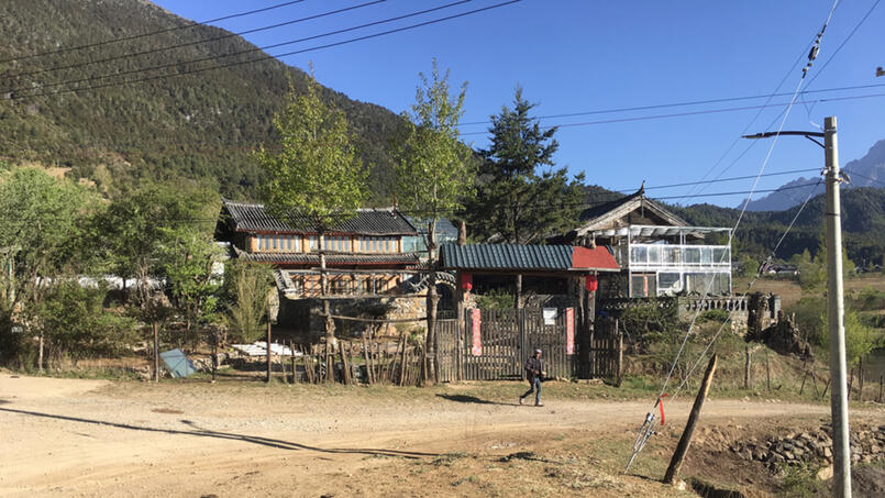
The ascent of Wenhai Mountain by any of the routes described, starts at Wenhai Banmanyuan Guesthouse (文海半满园客栈). Currently the only lodging available in Wenhai Village, you'll find it on the northwest side of Wenhai Lake at an elevation of 3,100 meters. The guesthouse has no internet presence and cannot be booked online. It caters mainly to foreign trekkers who book through European travel agencies that contract with local guides. I discovered the place by chance while walking around the lake.
For independent travelers, the only way to get in touch is on-site, that is, in person, or by phone. The current owner, He Tao (和涛), speaks Chinese only and can be reached at 13578393318. Overnight accommodation costs 200 yuan and includes breakfast, lunch and dinner. Slightly less if you provide your own lunch. If you want to hire a local trekking guide, the guesthouse can arrange it for 200 yuan per day.
If you don't speak Chinese, you may contact the Lijiang Xintuo Ecotourism Company by calling 13988826672. They have English speakers on staff. You may book the Wenhai guest house, or if you prefer, a home stay with a local family. They also provide English-speaking trekking guides.
Some years ago, a group of Wenhai residents banded together to create the Northwest Yunnan Ecotourism Association. In times past, the group organized local treks with overnight lodging at Wenhai Ecolodge. The building, now privately owned, sits directly behind the guesthouse mentioned above.
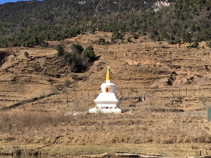
Despite a marvelous write-up on the website, the Ecolodge is no longer open to the public. Soon, however, there may be another lodging option in the valley. In 2019, ground broke on a new guesthouse at Wenhai Lake. It is located 200 meters south of the current one, next to a white stupa. According to one of the owners, He Shuyou (和述优), 15 rooms are under construction. With an upscale clientele in mind, overnight lodging will cost several times that of the existing guest house. The new facility is scheduled to open in April 2020.
Author Pieter Crow wishes to thank Lily Zhang (张文琼) and He Shuyou for assistance in preparing this article. Pieter is composing a series for GoKunming about hiking in Lijiang. For more, see his two-part article on circumambulating Haba Snow Mountain, as well as his explanation of where and how to hike Elephant Hill, Wenbi Mountain and Saddle Mountain, all just outside of Lijiang Old Town.
Images of primrose flowers, animal herds and summertime at Wenhai Lake: He Shuyou
Other images, except as noted: Pieter Crow


Comments
This article does not have comments yet. Be the first!
Login to comment